This is a level 3 geometry strand activity from the Figure It Out series.
A PDF of the student activity is included.

Click on the image to enlarge it. Click again to close. Download PDF (678 KB)
interpret a scale map
FIO, Level 3-4, Geometry, Who Lives Where? page 20
ruler
scale map of your area
string
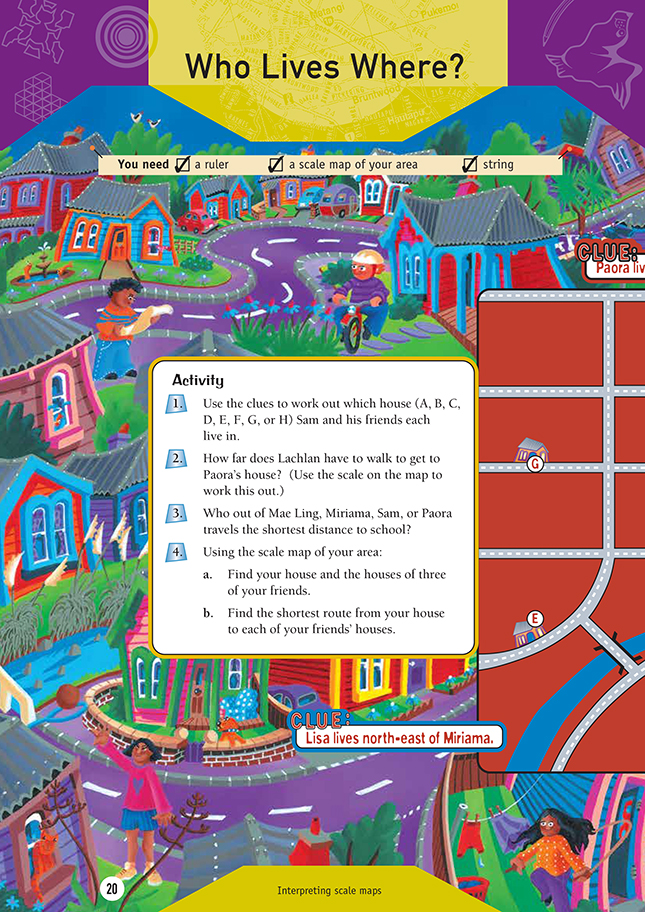
This activity gives students an opportunity to use logical thinking and direction clues to locate houses on a street map. Some students may need to revise the compass points for NE, SE, SW, and NW. Before the students begin question 3, you could ask them to estimate who travels the shortest distance to school. Paora, in house D, looks the closest, but does he travel the shortest distance when he goes
to school along the roads? (Note that the students need to calculate the distance travelled along the roads, not the distance of a straight line from each house to the school.) The students can then measure the route each friend takes to school and use the scale to work out who travels the shortest distance.
In question 4, the students need to use a local map to investigate different pathways, including the shortest path between two locations. They could use grid references to identify the location of places of interest such as the school, shopping centre, museum, sports fields, and so on. If a rural map is used, the students could identify farms, golf courses, and any other key features of the local area. They can then investigate the shortest paths between two locations, applying understanding of scale.
Answers to Activity
1. A – Sam
B – Matiu
C – Joe
D – Paora
E – Miriama
F – Mae Ling
G – Lachlan
H – Lisa
2. Approximately 800 m
3. Sam. (Mae Ling walks approximately 500 m, Miriama walks approximately 750 m, Sam walks approximately 400 m, and Paora walks approximately 550 m.)
4. Practical activity