This is a level 4 geometry strand activity from the Figure It Out series.
A PDF of the student activity is included.
Click on the image to enlarge it. Click again to close. Download PDF (369 KB)
use compass directions and scale drawings
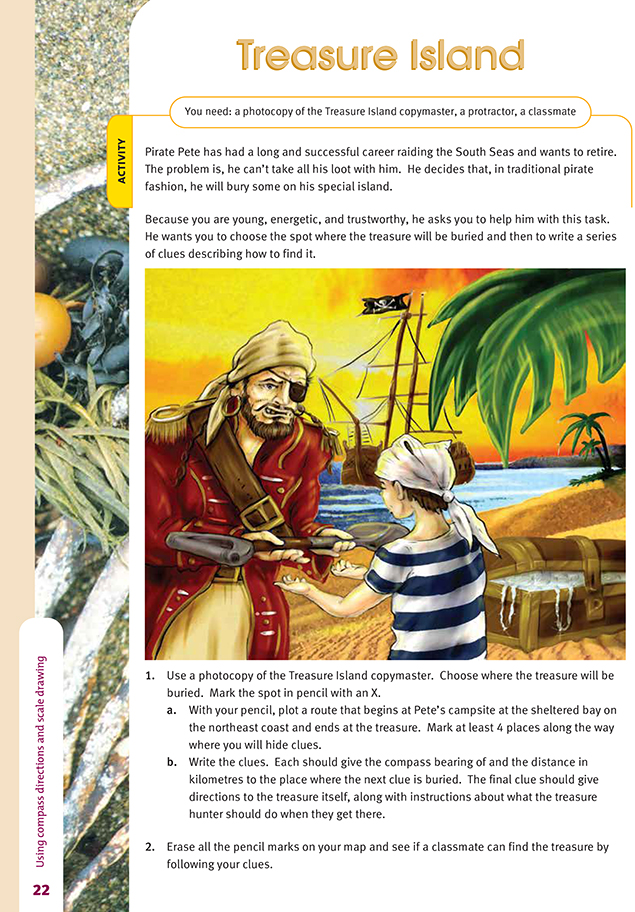
FIO, Level 4, Geometry, Book One, Treasure Island, page 22
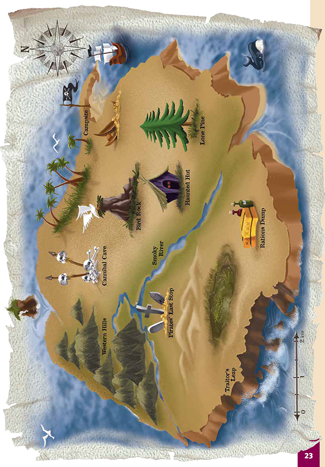
Copymaster of Treasure Island map
map
classmate
This activity goes beyond the previous activity in asking students to locate a series of connected points, using bearings and distances, as they would in orienteering. It gives them further practice using a protractor and stating bearings clockwise from north as well as working with scale distances. It also creates a context in which accuracy is very important. The cumulative effect of small inaccuracies in each clue will mean that the instructions are worthless and that the treasure will be lost forever!
When planning where to leave the clues, the students should:
- choose a resting place for the treasure that is some distance from the campsite
- remember that they are defining the location of the next clue, not describing how to get there
- zig-zag a bit to make treasure hunters work for their money
- use some of the landmarks, but for obvious reasons, they should not name these in their instructions.
Each clue must have:
- the bearing in degrees (measured clockwise from north and written using 3 digits)
- the distance from one point to the next as the crow flies.
Example:
- clue 1: bearing 190o; 2.75 km
- clue 2: bearing 305o; 2.5 km.
If your students enter into the spirit of the activity and want to invent cryptic verses or lines to go with their clues, that's fine.
Question 2 involves the students swapping their clues with a classmate and seeing if they can locate the spot where the treasure is buried. For them to succeed:
- the information they are given in the clues must be accurate
- they must interpret the details correctly
- they must carry out the instructions with a high level of accuracy.
As an extension activity, your students could investigate orienteering. They will find a useful introduction on this website: www.us.orienteering.org/OYoung
Answers to Activity
1. a.-b. Practical activity. Clues will vary.
2. Practical activity