This is a level 4 geometry strand activity from the Figure It Out series.
A PDF of the student activity is included.
Click on the image to enlarge it. Click again to close. Download PDF (649 KB)
apply compass directions and scale
FIO, Level 3-4, Geometry, Ringing the Road, page 31
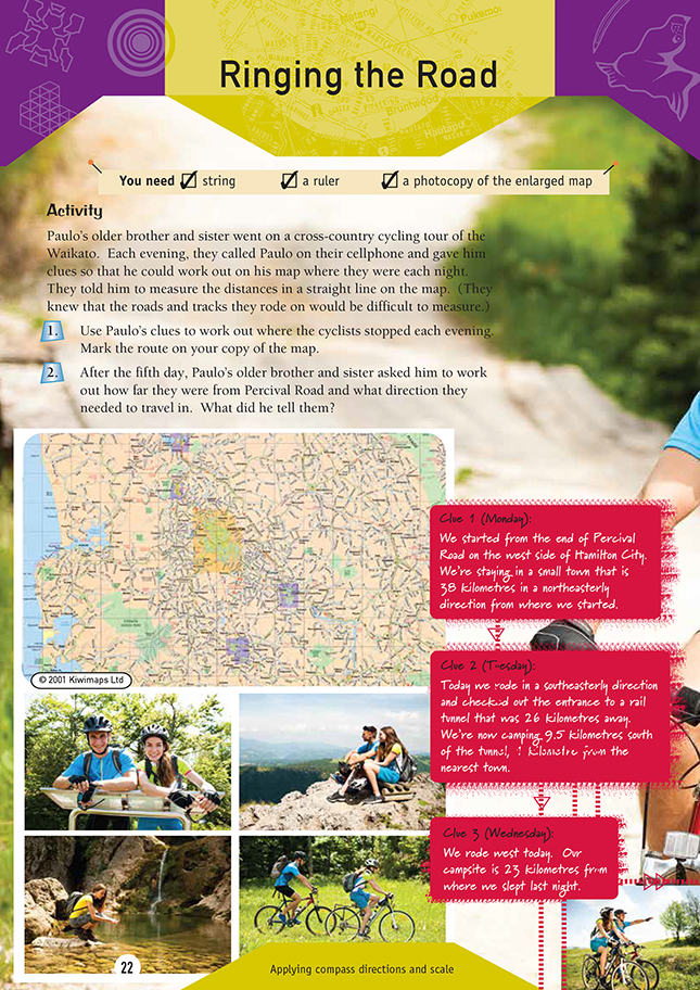
ruler
string
photocopy of map from Teachers' Notes page 14/15
This activity is similar to the preceding one on pages 20–21. The students need to apply an understanding of the compass points and scale to follow the route of Paulo’s brother and sister on their cycling tour. You may need to use the answers to help the students work out the clues. An A3 copymaster of the Waikato district map is provided in the centre section of these notes. As an extension, the students could use this map or a map of their own area to plan a cycling holiday.
You could set parameters. For example, the students need to:
• travel at least 25 kilometres per day
• reach home within 5 days
• allow for bad weather on the third day.
It is important to point out the scale of the map. In this case, the scale is 1 centimetre : 2.5 kilometres or 1 millimetre : 0.25 kilometres. To succeed with this exercise, the students must be familiar with measuring to scale. It would be a good idea to get them to measure the distances between towns and convert their ruler measurements to kilometres before doing the exercise. For example, for clue 1, a
measurement of 154 millimetres will give a distance of 38.5 kilometres (154 ÷ 4).
As noted on the student page, the distances measured are not the actual distances travelled (this sort of measuring would be very difficult on this sort of map). Instead, the distances are marked in a straight line from the starting point to the finishing point.
As an extension, use maps of the same area but different scales in order to show the difference in graphical representation. You could discuss what the different maps could be needed for.
Answers to Activity
1. Practical activity. Teacher to check map:
- Clue 1 takes them to Elstow.
- Clue 2 takes them to the start of the Kaimai Rail Tunnel and on to a point 1 km from Okauia.
- Clue 3 takes them directly west to Waterworks Rd.
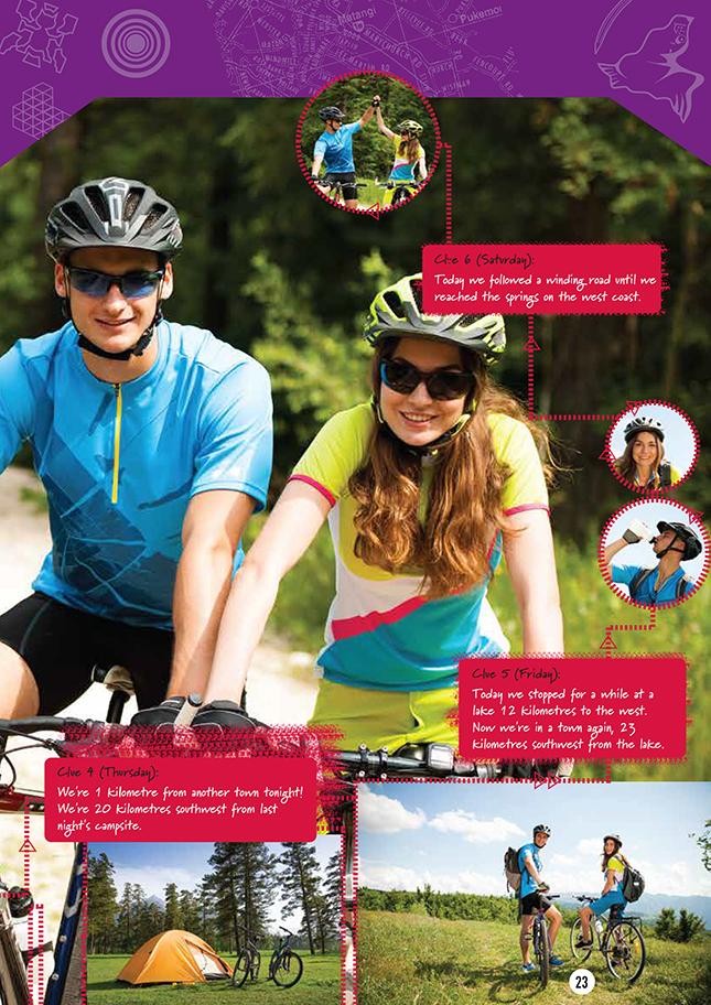
- Clue 4 takes them to a point that is 1 km from Monvale.
- Clue 5 takes them to Lake Ruatuna and on to Ngutuna.
- Clue 6 takes them to Te Puia Springs.
2. The return trip to Percival Rd is 58.25 kilometres in a northeasterly direction.