This is a level 4 geometry and measurement activity from the Figure It Out theme series.
A PDF of the student activity is included.
Click on the image to enlarge it. Click again to close. Download PDF (746 KB)
interpret the scale of a map
use speeds and times to construct a timetable
FIO, Level 3, Theme: At Camp, Planning the Tramp, pages 14-15
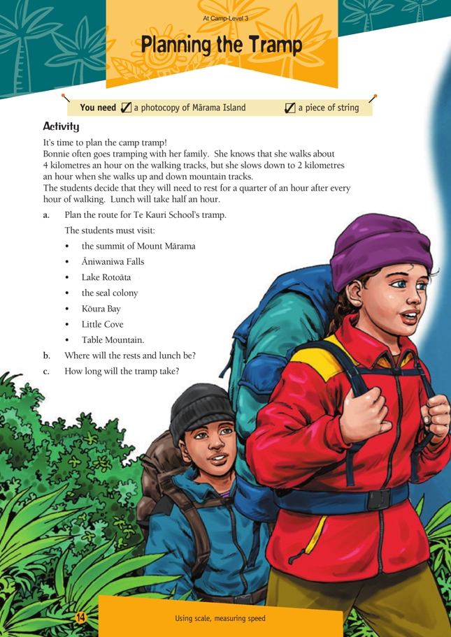
A piece of string
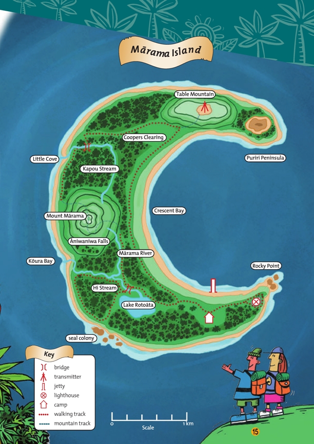
Students will find a photocopy of the map useful for marking out routes, resting places, and a lunch site and for measuring distances. A copymaster of Mārama Island is provided at the back of this booklet. Students will need some guidance before attempting this activity. You could discuss the following points:
• How are the distances on the map measured?
Discuss what the scale line at the bottom of the page means. The scale is
1 centimetre : 200 metres, though it is easier for students to interpret distances in whole kilometres.
Give students some simple distances to find to confirm their knowledge of scale.
• How fast will the trampers walk?
Speed is a difficult concept for students to understand. This situation is simplified to include only two different speeds, 4 kilometres per hour for flat terrain and 2 kilometres per hour for steep terrain. The mountain track and walking track symbols in the key will help students work out when a climb begins. Check on their comprehension of speed by asking them questions such as:
“How long will it take to climb from the base of Mount Mārama to the top?” (This is about 800 metres, which will take about 24 minutes at 2 kilometres per hour. This could be explained as:
At 2 kilometres an hour, it takes 60 minutes to go 2 000 metres. So to go 1 metre, it takes 60/2 000 minutes. To go 800 metres, it takes 800 x 60/2 000 = 24 minutes.)
“How long would it take to walk along the beach from the seal colony to Koura Bay?” (This is a distance of just over 1 kilometre, which will take just over 15 minutes at 4 kilometres per hour.)
• Where can the trampers walk?
The walking tracks are shown by dotted lines. The beaches are also accessible for walking.
You could ask more capable students to use orienteering directions involving distance and compass bearings to explain their tramp route.
Answers to Activity
a. Answers will vary according to the routes chosen.
b. Answers will vary.
c. About 41/2 to 51/2 hours