Fun Run
This is a Level 3 Geometry activity from the Figure It Out Series.
A PDF of the student activity is included.
Click on the image to enlarge it. Click again to close. Download PDF (353 KB)
- Interpreting simple scale maps.
- A ruler
- String
- FIO, Level 3, Geometry, Fun Run, pages 14-15
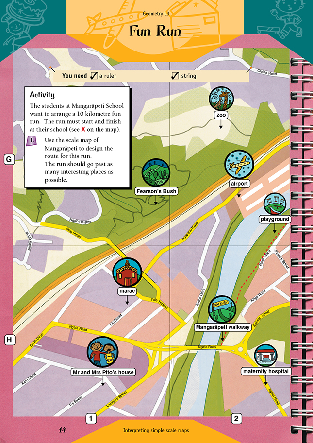
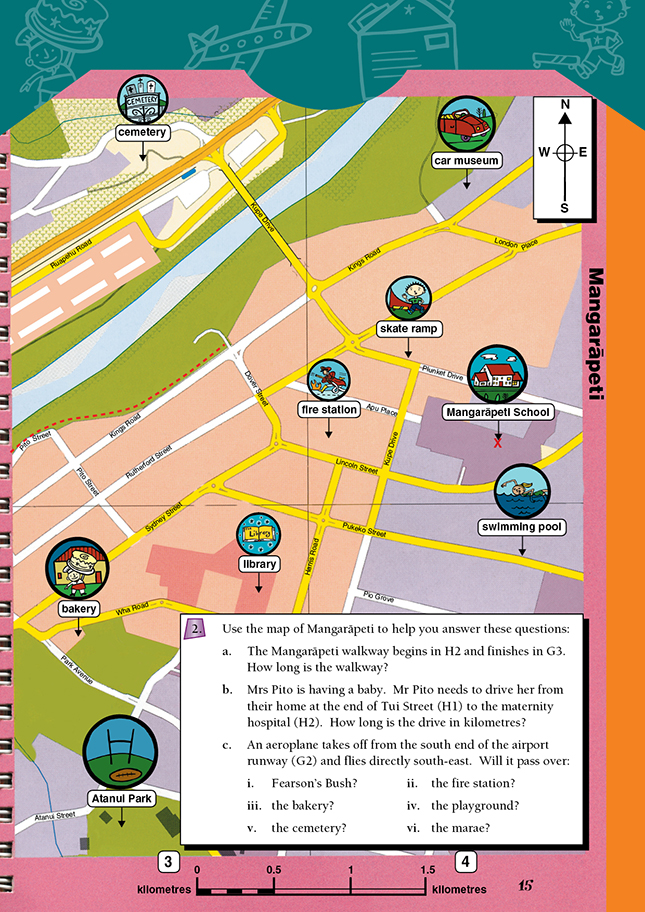
To answer questions 1, 2a, and 2b, students need to work out the scale used on the map. From the key at the bottom of the map, they can see that 2.5 centimetres equals 0.5 kilometres, so the scale is 5 centimetres : 1 kilometre.
Students could look out for interesting places the run might go past. They should realise that there are a number of routes the fun run might take and that certain routes might be better than others.
Co-ordinates have been used in question 2. Students need to understand that to find co-ordinates on most maps, they need to first move up and then out. Note that graphs normally have co-ordinates read as (x, y). Maps reverse the order.
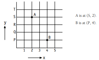
These co-ordinates are called ordered pairs. Up is known as the y axis. Out is known as the x axis.
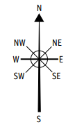
Check that students know the points of the compass.
Here are some extension ideas:
- Increase the distance of the fun run.
- Students who are participating in the fun run need to train. Plan some interesting jogging routes of 2, 3, or 4 kilometres.
- Measure a 1 kilometre distance. How long would it take you to run this distance? (This connects to Measurement.)
- Discuss and use the scale found in an atlas. Plan various routes around New Zealand for a range of long-distance activities.
Answers to Activity
- Answers will vary.
- a. On the map it measures approximately 180 mm, which is 3.6 km.
b. It measures approximately 145 mm, which is approximately 2.9 km. (Note that you have to go round the roundabout.)
c. It passes over the playground and the bakery.